Breadcrumb

  1. Home
  2. Search Maps
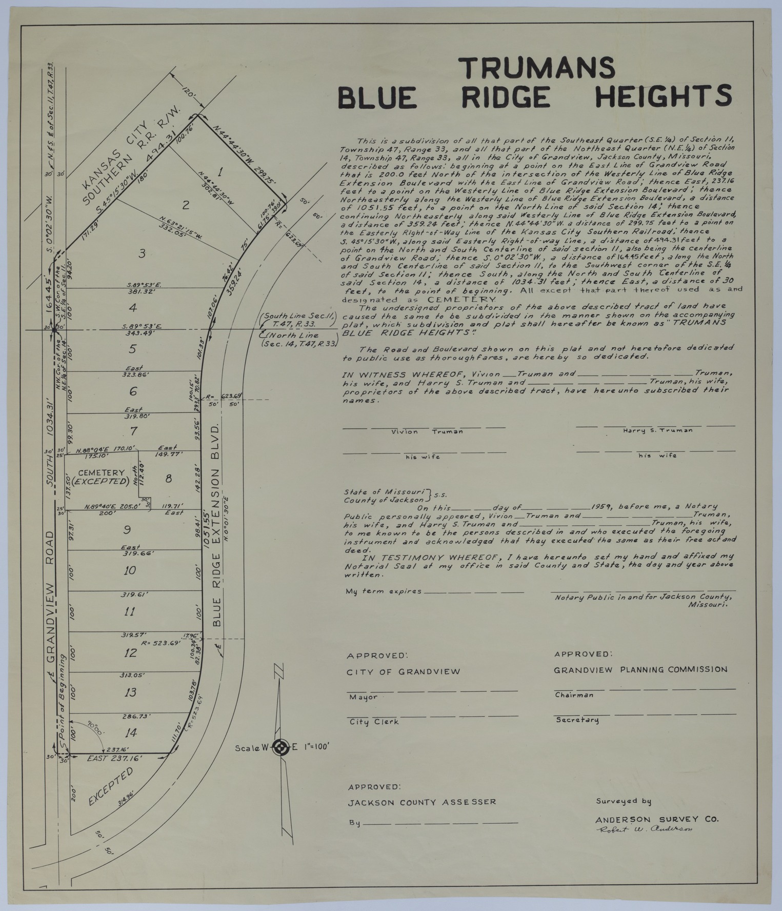
  3. Drawing of the Planned Truman's Blue Ridge Heights in Grandview, Missouri

Drawing of the Planned Truman's Blue Ridge Heights in Grandview, Missouri

Drawing of the Planned Truman's Blue Ridge Heights in Grandview, Missouri
Accession Number
M120-01
Cartographer
Anderson Survey Company, Robert W. Anderson.
Photo Color
Color
Physical Size
21 3/4 X 18 1/2 inches
Restrictions
Undetermined
Scale
1 inch = 100 feet
TIF Identifier
M120-01.tif
Rights

The Library is unaware of any copyright claims to this item; use at your own risk.

Note: If you use this image, rights assessment and attribution are your responsibility.

Credit: Anderson Survey Company, Robert W. Anderson.

Courtesy Harry S. Truman Library & Museum, Independence, Missouri.

Attention media: Please make note of this item's map number. Print out this page and retain it for your permissions records before downloading this image file for possible publication. Library staff cannot sign permissions forms or provide additional paperwork. The Library charges no usage fees for downloaded images. Fees are charged for higher resolution scans.

Description

A survey titled "Truman's Blue Ridge Heights." This survey describes the apportionment of land previously part of the Harry S. Truman Farm in Grandview, Missouri. This is an unsigned copy of the original, M119.

Date(s)