Breadcrumb

  1. Home
  2. Library Collections
  3. Photographs
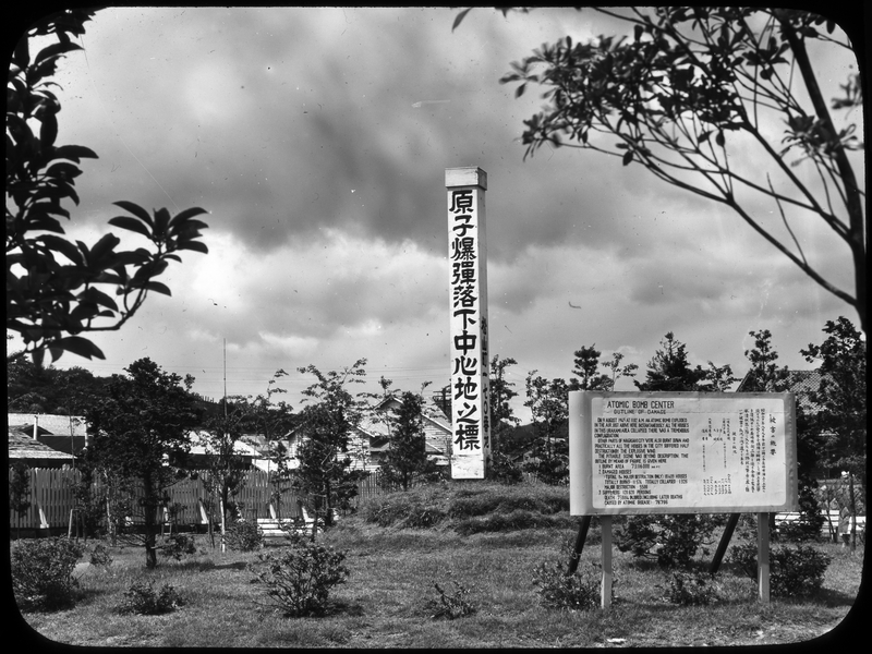
  4. Marker Showing the Atomic Bomb Hypocenter in Nagasaki

Marker Showing the Atomic Bomb Hypocenter in Nagasaki

2023-525 (untitled)
Accession Number
2023-525
2.2" x 3"
Black & White
Keywords
Rights

The Library is unaware of any copyright claims to this item; use at your own risk.

Note: If you use this image, rights assessment and attribution are your responsibility.

Harry S. Truman Library & Museum.

Attention media: Please make note of this item's accession number. Print out this page and retain it for your permissions records before downloading this image file for possible publication. Library staff cannot sign permissions forms or provide additional paperwork. The Library charges no usage fees for downloaded images.

Description

Column marking the location of the atomic bomb hypocenter in Nagasaki, Japan. The sign near the cenotaph, which is written both in English and Japanese, says: "Atomic Bomb Center. Outline of Damage. On 9 August 1945 at 1102 A.M. an atomic bomb exploded in the air just above here. Instantaneously all the houses in this Urakami area collapsed. There was a tremendous conflagration. Other parts of Nagasaki City were also burnt down and practically all the houses in the city suffered half destruction by the explosive wind. The pitiable scene was beyond description. The outline by means of figure is given here. 1. Burnt area: 73,116,000 sq. ft. 2. Damaged houses (total & major destruction only): 18,409 houses. Totally burnt - 11,574. Totally collapsed - 1326. Major destruction - 5509. 3. Sufferers: 120,820 persons. Death 73,884. Injured (including later deaths caused by atomic disease) - 76,796."

Date(s)
ca.
1950