Breadcrumb

  1. Home
  2. Search Maps
  3. Map of American and Soviet Zones of Operation

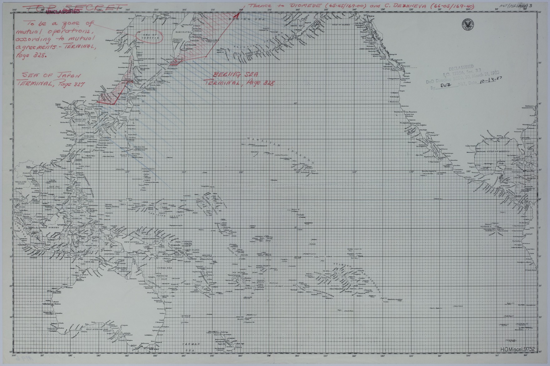
Map of American and Soviet Zones of Operation

Map of American and Soviet Zones of Operation
Accession Number
M96
Cartographer
Hydrographic Office, United States Navy. H.O. Miscel. 9752.
Photo Color
Color
Physical Size
14 1/4 X 21 1/2 inches
Restrictions
Unrestricted
TIF Identifier
M96.tif
Rights

This item is in the public domain and can be used freely without further permission.

Note: If you use this image, rights assessment and attribution are your responsibility.

Credit: Hydrographic Office, United States Navy. H.O. Miscel. 9752.

Courtesy Harry S. Truman Library & Museum, Independence, Missouri.

Attention media: Please make note of this item's map number. Print out this page and retain it for your permissions records before downloading this image file for possible publication. Library staff cannot sign permissions forms or provide additional paperwork. The Library charges no usage fees for downloaded images. Fees are charged for higher resolution scans.

Description

An American map of the Pacific Ocean that shows the coastline of North America, Asia, and Australia. Handwriting and markings, in red and blue pencil, describe agreements made between the United States and the Soviet Union at the Potsdam Conference. The Sea of Okhotsk is circled and is described as follows: "To be a zone of mutual operations, according to mutual agreements-Terminal, Page 328." Separate zones of operation in the Sea of Japan are identified by red pencil markings (Soviet Union) and blue pencil markings (United States). Handwriting relating to this agreement reads: "Sea of Japan Terminal, Page 327." Separate zones of operation in the Bering Sea are identified by red pencil markings (Soviet Union) and blue pencil markings (United States). Handwriting relating to this agreement reads: "Bering Sea Terminal, Page 328" and "Thence to Diomede (65-45/169) and C. Dezhneva (66-05/169-40)."

Date(s)