Breadcrumb

  1. Home
  2. Search Maps
  3. Map of the 35th Division

Map of the 35th Division

Map of the 35th Division
Accession Number
M638
Photo Color
Color
Physical Size
12 X 16 inches
Restrictions
Undetermined
TIF Identifier
M638.tif
Rights

The Library is unaware of any copyright claims to this item; use at your own risk.

Note: If you use this image, rights assessment and attribution are your responsibility.

Credit:

Courtesy Harry S. Truman Library & Museum, Independence, Missouri.

Attention media: Please make note of this item's map number. Print out this page and retain it for your permissions records before downloading this image file for possible publication. Library staff cannot sign permissions forms or provide additional paperwork. The Library charges no usage fees for downloaded images. Fees are charged for higher resolution scans.

Description

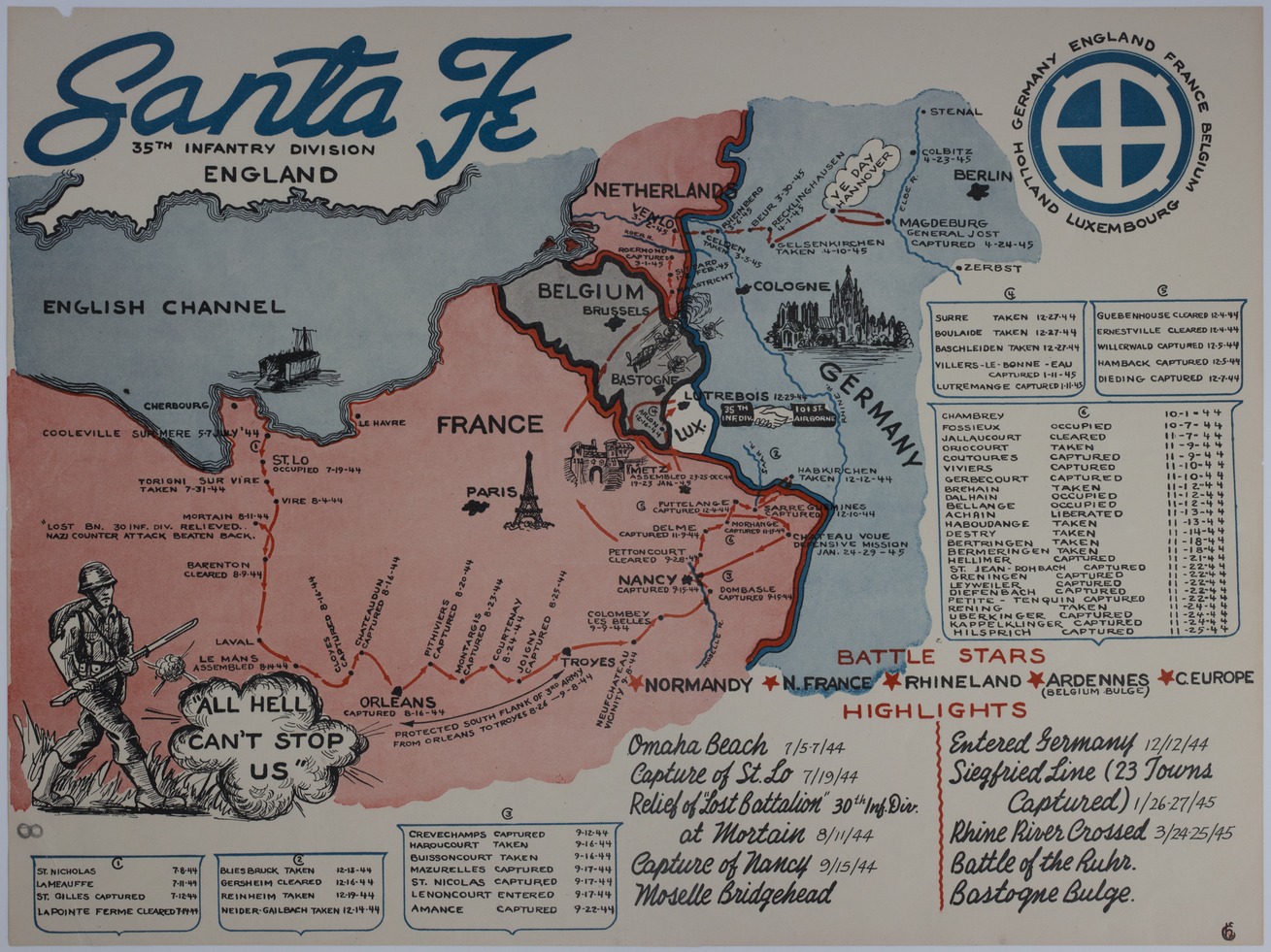
An American map titled "Santa Fe: 35th Infantry Division." The map of the Western front shows the route taken by the 35th Division from its landing at Omaha to V.E. Day in Hanover, Germany. Printed text lists the towns the 35th Division passed through, along with the dates they were occupied, cleared, taken, captured, and liberated. Other text lists the battle stars earned by the Division, campaigns waged, and Division interaction with other Allied units and the German Army. Handwriting on the back indicates that this map is part of the President's Personal File. The handwriting reads in part: "PPF 9-W, 6-3-47."

Date(s)