Breadcrumb

  1. Home
  2. Search Maps
  3. Map of the Western Front

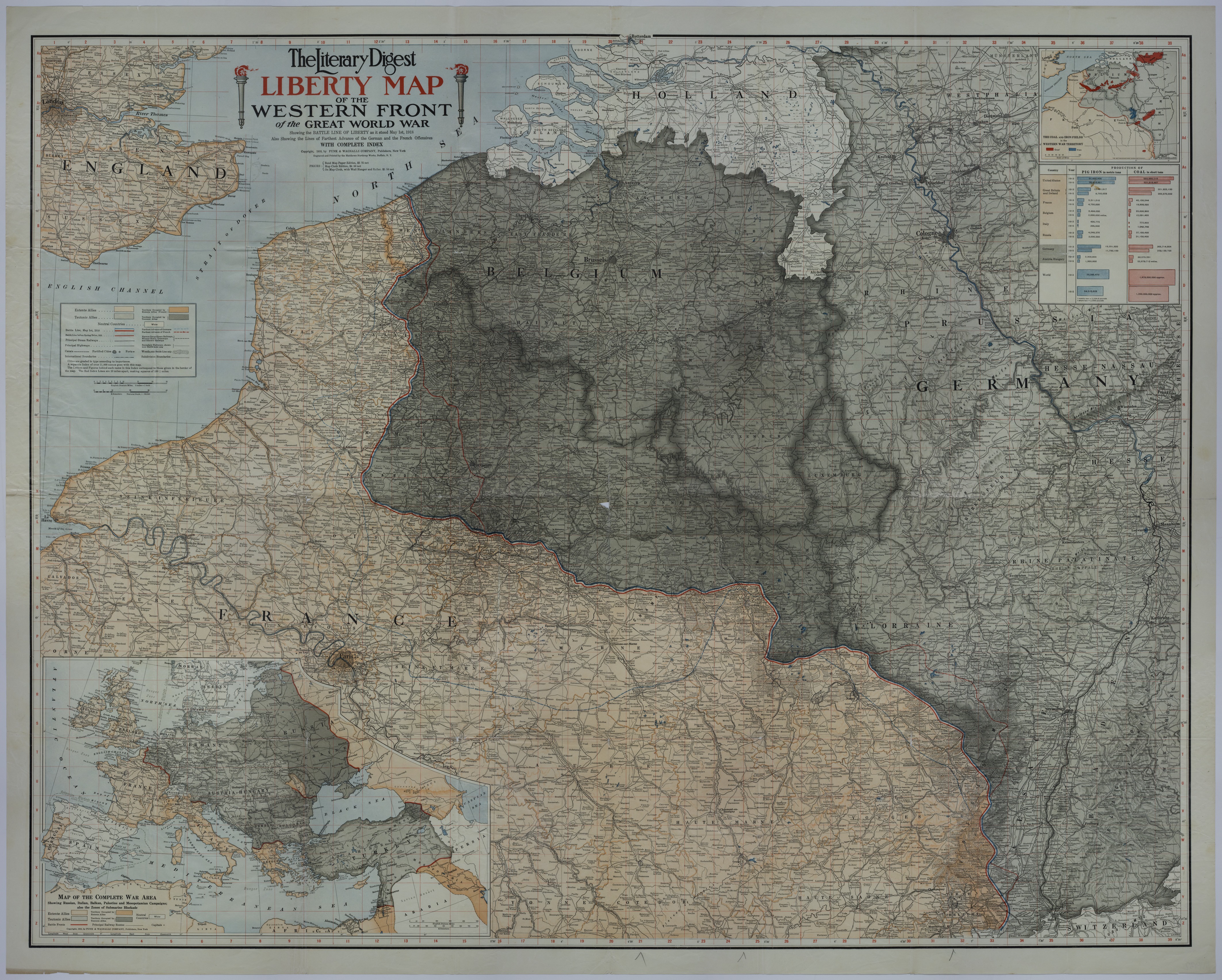
Map of the Western Front

Map of the Western Front
Accession Number
M1932
Cartographer
Funk and Wagnalls Company. Coal and Iron Fields Inset Map: The Matthews-Northrup Works, Buffalo, NY.
Photo Color
Color
Physical Size
42 X 52 inches
Restrictions
Unrestricted
Scale
1:500,000. Complete War Area Inset: 3 inches = 500 miles. Coal and Iron Fields Inset: 1 1/2 inches = 100 miles.
TIF Identifier
M1932.tif
Rights

This item is in the public domain and can be used freely without further permission.

Note: If you use this image, rights assessment and attribution are your responsibility.

Credit: Funk and Wagnalls Company. Coal and Iron Fields Inset Map: The Matthews-Northrup Works, Buffalo, NY.

Courtesy Harry S. Truman Library & Museum, Independence, Missouri.

Attention media: Please make note of this item's map number. Print out this page and retain it for your permissions records before downloading this image file for possible publication. Library staff cannot sign permissions forms or provide additional paperwork. The Library charges no usage fees for downloaded images. Fees are charged for higher resolution scans.

Description

An American map titled "The Literary Digest Liberty Map of the Western Front of the Great World War." The map shows steam railways, highways, mineral roads, tramways, electric railways, rivers, canals, fortified cities, forts, woods, international boundaries, subdivision boundaries, and other details. This map also identifies the areas occupied by the Entente and Teutonic Allies, lines of farthest German and French advance, the battle line before the German Spring Offensive, and the battle line as of May 1, 1918. Several areas are circled in pencil including: Boncourt, Commercy, Toul, Nancy, Belfort, Langres, and Chatillon-sur-Seine. The inset map of the "Complete War Area" shows the areas occupied by the Entente and Teutonic Allies, principal railway routes, rivers, international boundaries, submarine blockade zones, and the battle fronts of the Western, Russian, Italian, Balkan, Palestine, and Mesopotamian campaigns. Le Mans and Toul, France are circled in pencil. The other inset map locates "The Coal and Iron Fields in the Western War Territory." This inset is accompanied by a table that shows the production of pig iron and coal in the United States, Great Britain and Ireland, France, Belgium, Italy, Russia, Germany, Austria-Hungary, and the world in 1913 and 1915. Donated by Myron Hill.

Date(s)
ca.