Breadcrumb

  1. Home
  2. Search Maps
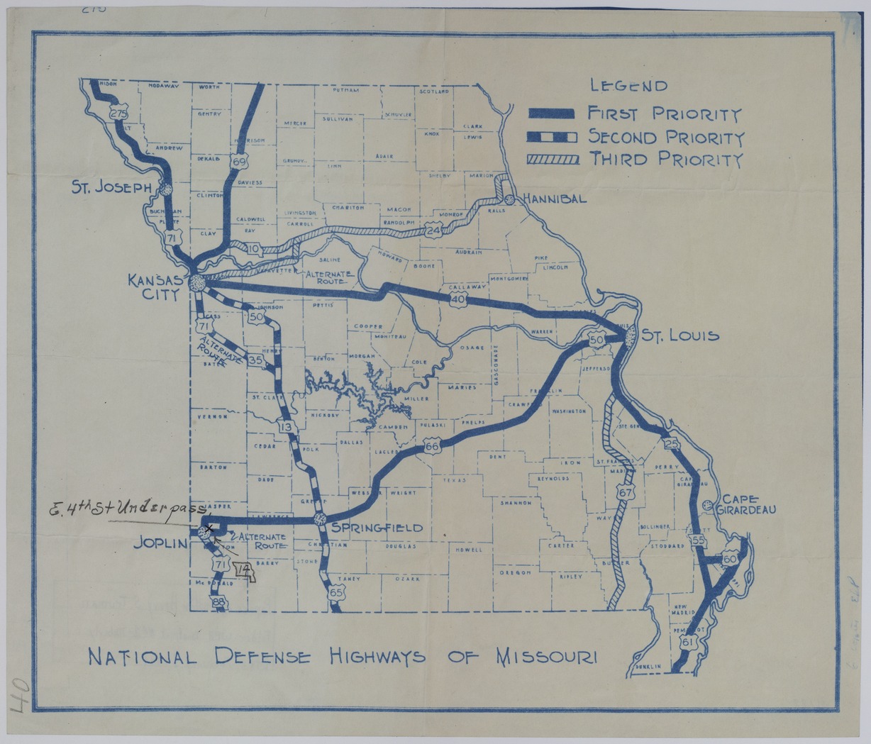
  3. Map of National Defense Highways in Missouri

Map of National Defense Highways in Missouri

Map of National Defense Highways in Missouri
Accession Number
M188
Keywords
Photo Color
Color
Physical Size
13 1/4 X 15 1/2 inches
Restrictions
Undetermined
TIF Identifier
M188.tif
Rights

The Library is unaware of any copyright claims to this item; use at your own risk.

Note: If you use this image, rights assessment and attribution are your responsibility.

Credit:

Courtesy Harry S. Truman Library & Museum, Independence, Missouri.

Attention media: Please make note of this item's map number. Print out this page and retain it for your permissions records before downloading this image file for possible publication. Library staff cannot sign permissions forms or provide additional paperwork. The Library charges no usage fees for downloaded images. Fees are charged for higher resolution scans.

Description

A map titled "National Defense Highways of Missouri." The map places first, second, or third priority to these highways. Missouri Route 14 and the "E. 4th St. Underpass" is marked in pencil near Joplin, Missouri. Other handwriting on the front reads: "40" and "6 copies, ERP." Handwriting on the back reads: "Papers of Senator Harry S. Truman. Folder: WPA District No. 1-Moberly. Ltr: February 1, 1941."

Date(s)