Breadcrumb

  1. Home
  2. Search Maps
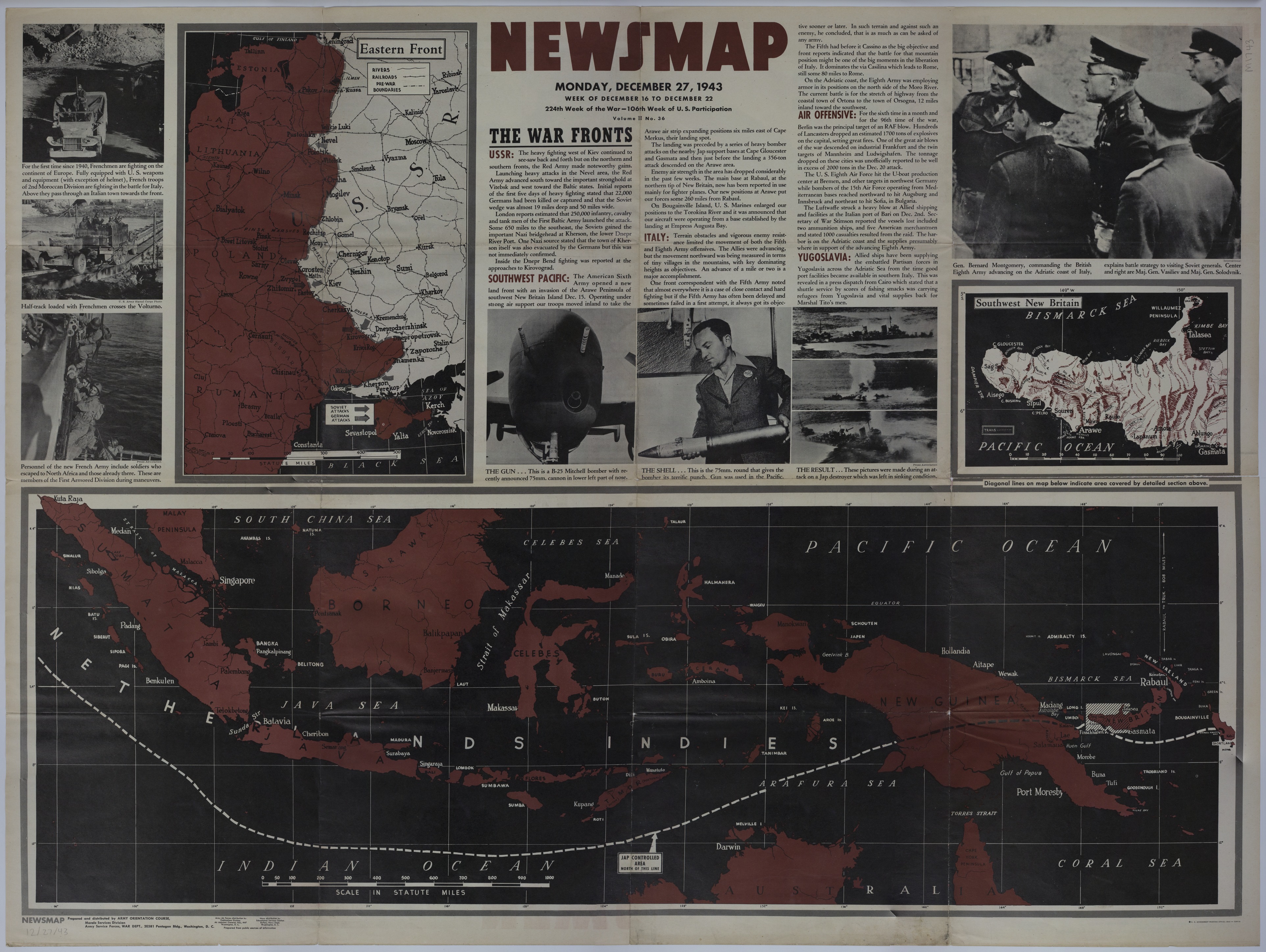
  3. Map of the Eastern Front

Map of the Eastern Front

Map of the Eastern Front
Accession Number
M1743
Cartographer
Army Orientation Course, Morale Services Division, Army Service Forces, War Department.
Photo Color
Color
Physical Size
35 X 47 inches
Restrictions
Unrestricted
Scale
7 inches = 500 miles. Dutch East Indies: 11 inches = 1000 miles. New Britain: 6 1/2 inches = 100 miles
TIF Identifier
M1743.tif
Rights

This item is in the public domain and can be used freely without further permission.

Note: If you use this image, rights assessment and attribution are your responsibility.

Credit: Army Orientation Course, Morale Services Division, Army Service Forces, War Department.

Courtesy Harry S. Truman Library & Museum, Independence, Missouri.

Attention media: Please make note of this item's map number. Print out this page and retain it for your permissions records before downloading this image file for possible publication. Library staff cannot sign permissions forms or provide additional paperwork. The Library charges no usage fees for downloaded images. Fees are charged for higher resolution scans.

Description

An American map titled "Newsmap, Monday, December 27, 1943." The map of the Eastern front shows rivers, railroads, pre-war boundaries, battle lines, and the location of Soviet and German attacks. The map of the Dutch East Indies highlights Japanese controlled areas north of the printed line. The map of southwest New Britain shows rivers, trails, relief, and other details. Printed text and photographs reveal news on multiple fronts.

Date(s)