Breadcrumb

  1. Home
  2. Search Maps
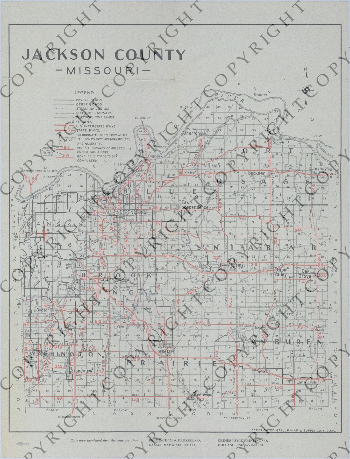
  3. Map of Jackson County, Missouri Road Improvements

Map of Jackson County, Missouri Road Improvements

Map of Jackson County, Missouri Road Improvements
Accession Number
M156
Cartographer
Copyright: Gallup Map and Supply Company, Kansas City, Missouri. Bermingham and Prosser Co., Grimes-Joyce Printing Co., Holland Engraving Co.
Photo Color
Color
Physical Size
22 X 16 3/4 inches
Restrictions
Restricted
TIF Identifier
M156.tif
Rights

This item is copyrighted and cannot be published, reproduced, or otherwise used without the explicit permission of the copyright holder.

Note: If you use this image, rights assessment and attribution are your responsibility.

Credit: Copyright: Gallup Map and Supply Company, Kansas City, Missouri. Bermingham and Prosser Co., Grimes-Joyce Printing Co., Holland Engraving Co.

Courtesy Harry S. Truman Library & Museum, Independence, Missouri.

Attention media: Please make note of this item's map number. Print out this page and retain it for your permissions records before downloading this image file for possible publication. Library staff cannot sign permissions forms or provide additional paperwork. The Library charges no usage fees for downloaded images. Fees are charged for higher resolution scans.

Description

A map in a pamphlet titled "Official Highway Map of Jackson County, Missouri: Jackson County Highway Celebration, October 12, 1932." The map shows paved roads, other roads, steam railroads, electric railways, political township lines, schools, U.S. interstate highways, state highways, coordinate lines, paved highways completed under the bond issue, and the bond issue roads to be completed. The rest of the pamphlet, on the back, details "The Jackson County Plan," shows the people responsible for implementing the plan, and provides drawings and photos of the efforts to remodel and build Jackson County courthouses in Independence and Kansas City.

Date(s)