Breadcrumb

  1. Home
  2. Search Maps
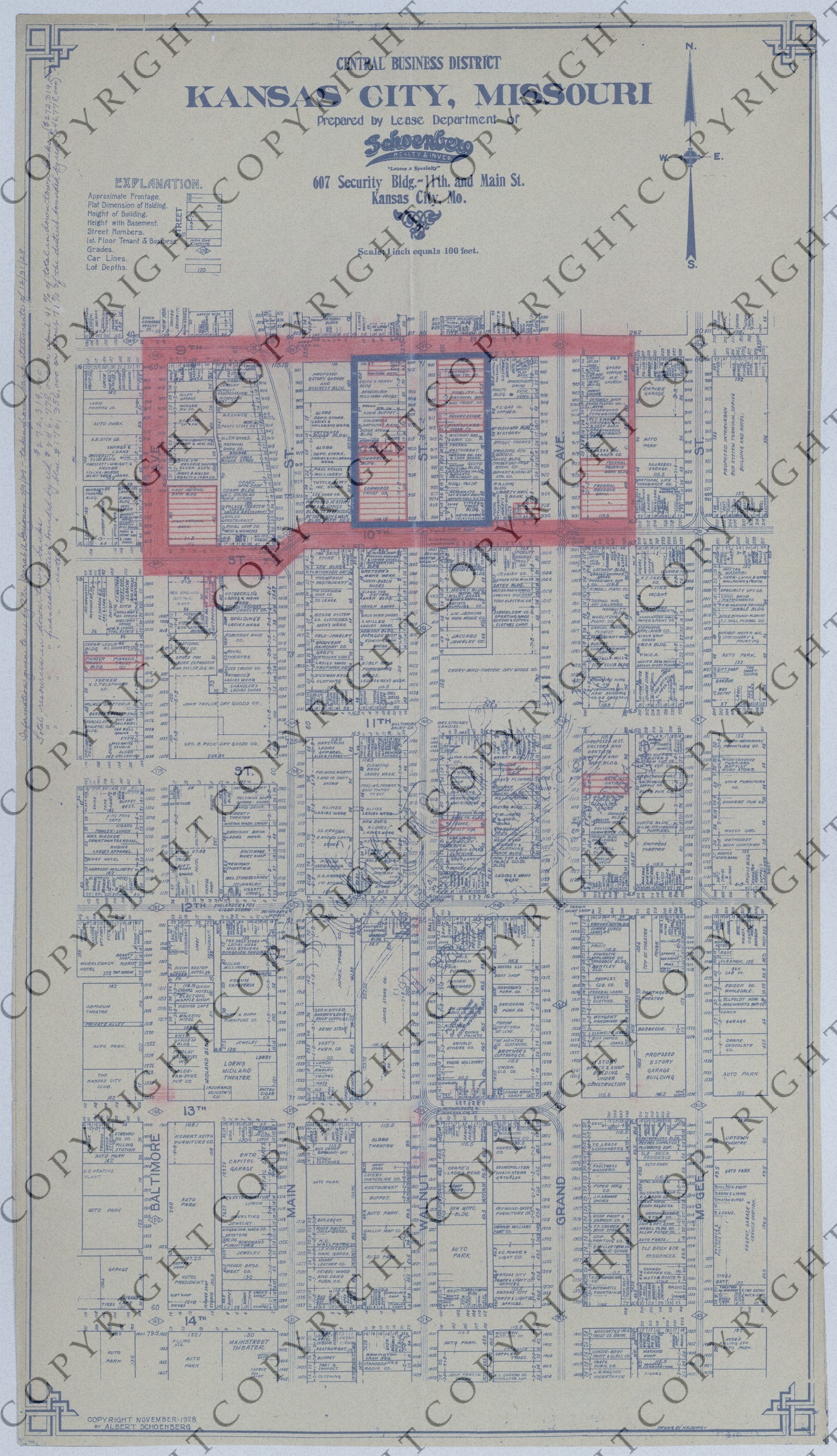
  3. Map of the Central Business District of Kansas City, Missouri

Map of the Central Business District of Kansas City, Missouri

Map of the Central Business District of Kansas City, Missouri
Accession Number
M144
Cartographer
Copyright: Albert Schoenberg. Prepared by: Lease Department of Schoenberg Realty & Invco., Kansas City, Missouri. Drawn by: H.H. Denney.
Photo Color
Color
Physical Size
33 X 18 3/4 inches
Restrictions
Restricted
Scale
1 inch = 100 feet
TIF Identifier
M144.tif
Rights

This item is copyrighted and cannot be published, reproduced, or otherwise used without the explicit permission of the copyright holder.

Note: If you use this image, rights assessment and attribution are your responsibility.

Credit: Copyright: Albert Schoenberg. Prepared by: Lease Department of Schoenberg Realty & Invco., Kansas City, Missouri. Drawn by: H.H. Denney.

Courtesy Harry S. Truman Library & Museum, Independence, Missouri.

Attention media: Please make note of this item's map number. Print out this page and retain it for your permissions records before downloading this image file for possible publication. Library staff cannot sign permissions forms or provide additional paperwork. The Library charges no usage fees for downloaded images. Fees are charged for higher resolution scans.

Description

A map of the "Central Business District" of Kansas City, Missouri. The map shows approximate frontage, plat dimension of holdings, height of buildings, height with basements, street numbers, first floor tenants and businesses, grades, car lines, lot depths, and other details. Annotations on this map relate to banks and the Lease Department of Schoenberg Realty & Invco. Handwriting along the top left margin explains the areas highlighted in red and blue. In part, the handwriting reads: "Information given to us by Mr. Barat A. Guignon, 2/9/29-taken from bank statements of 12/31/28." Donated by Albert Schoenberg.

Date(s)
ca.