Breadcrumb

  1. Home
  2. Search Maps
  3. Map of Allied and German Defenses and Positions

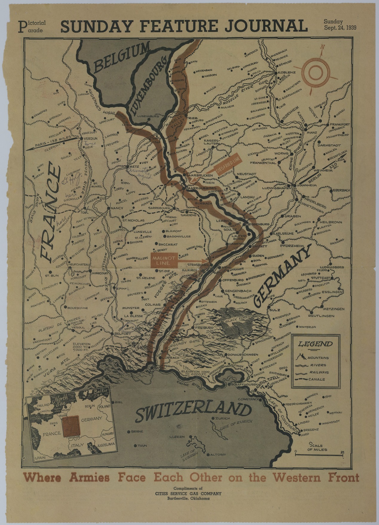
Map of Allied and German Defenses and Positions

Map of Allied and German Defenses and Positions
Accession Number
M1094
Cartographer
Sunday Feature Journal. Compliments of Cities Service Gas Company, Bartlesville, Oklahoma.
Photo Color
Color
Physical Size
21 1/2 X 15 1/4 inches
Restrictions
Undetermined
Scale
2 inches = 25 miles
TIF Identifier
M1094.tif
Rights

The Library is unaware of any copyright claims to this item; use at your own risk.

Note: If you use this image, rights assessment and attribution are your responsibility.

Credit: Sunday Feature Journal. Compliments of Cities Service Gas Company, Bartlesville, Oklahoma.

Courtesy Harry S. Truman Library & Museum, Independence, Missouri.

Attention media: Please make note of this item's map number. Print out this page and retain it for your permissions records before downloading this image file for possible publication. Library staff cannot sign permissions forms or provide additional paperwork. The Library charges no usage fees for downloaded images. Fees are charged for higher resolution scans.

Description

An American map titled "Where Armies Face Each Other on the Western Front." The map highlights the Maginot and Siegfried Lines but is annotated with World War I subject areas. Pencil annotations mark the location of the General Headquarters of the American Expeditionary Forces at Chaumont and also highlights the areas of Verdun, Mecrin, Gironville, Gondrecourt, Metz, and Kruth.

Date(s)