Breadcrumb

  1. Home
  2. Search Maps
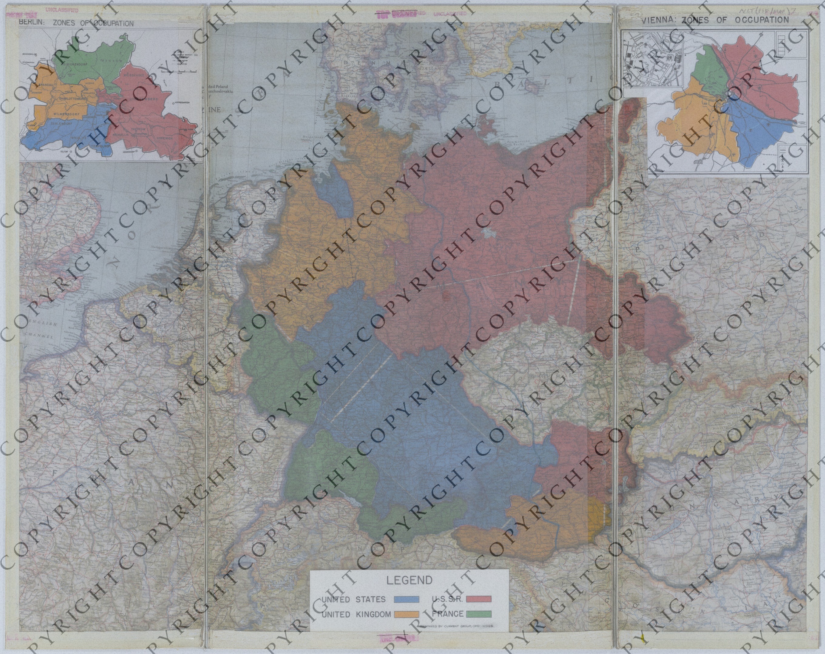
  3. Map of the Post-War Zones of Occupation in Europe

Map of the Post-War Zones of Occupation in Europe

Map of the Post-War Zones of Occupation in Europe
Accession Number
M101
Cartographer
Cartographic Section, National Geographic Society, National Geographic Magazine. Copyright, July 1944. Annotations: Current Group, O.P.D.-War Department General Staff. Insets: Unknown.
Photo Color
Color
Physical Size
25 3/4 X 32 3/4 inches
Restrictions
Restricted
Scale
1:2,000,000. Berlin Inset: 1 1/2 inches = 6 miles. Vienna Inset: None.
TIF Identifier
M101.tif
Rights

This item is copyrighted and cannot be published, reproduced, or otherwise used without the explicit permission of the copyright holder.

Note: If you use this image, rights assessment and attribution are your responsibility.

Credit: Cartographic Section, National Geographic Society, National Geographic Magazine. Copyright, July 1944. Annotations: Current Group, O.P.D.-War Department General Staff. Insets: Unknown.

Courtesy Harry S. Truman Library & Museum, Independence, Missouri.

Attention media: Please make note of this item's map number. Print out this page and retain it for your permissions records before downloading this image file for possible publication. Library staff cannot sign permissions forms or provide additional paperwork. The Library charges no usage fees for downloaded images. Fees are charged for higher resolution scans.

Description

A map that has been annotated to show the post-war zones of occupation in Europe. The plastic overlay, taped to the map, has a black dashed line that highlights the distance between American zones and a blue line that presumably shows the extent of Soviet influence. The attached inset of the Berlin zones of occupation shows airfields, district boundaries as of 1938, railroads, main stations, and bus stations. The attached inset of the Vienna zones of occupation shows boundaries, railroads, airfields, communication centers, and other details.

Date(s)
ca.